
Smith's Map of England & Wales, Containing the whole of the Turnpike Roads, Railways & Canals
- printer:
- C. Smith & Son
![]() This image is released under a CC BY-NC-SA 4.0 Licence
This image is released under a CC BY-NC-SA 4.0 Licence
Buy this image as a print
BuyLicense this image for commercial use at Science and Society Picture Library
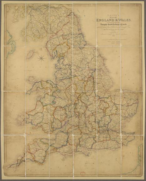
LicenseColour-engraved map. Smith's Map of England & Wales
Science Museum Group
© The Board of Trustees of the Science Museum
Colour-engraved map. Smith's Map of England & Wales, Containing the whole of the Turnpike Roads, Railways & Canals : with the Distance from London to every Principal Town and from one Market Town to Another / Printed for C. Smith & Son, mapsellers, 172 Strand. 1845. Scale 1" : c.14m. Part of the John Phillimore Collection: cat. 1, 1845, page 8. Previously folded, it has been conserved and mounted on linen.
Details
- Category:
- Railway Maps & Plans
- Object Number:
- 2000-1392
- Materials:
- paper
- Measurements:
-
overall: 770 mm x 610 mm
- type:
- map
- credit:
- Sotheby and Compan


