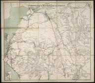

Map and section of the Brighton Railway ....
- Made:
- 1841
Coloured-engraved map. Map and section of the Brighton Railway, shewing its connexion with the South Eastern and Croydon Railways, together with the various other lines for thirty miles north of the River Thames. 1841 Sept. Scale (main map) 1" : 3m. Published by J. R. Jobbins, 3 Warwick Court (and) R. Tyas, 8 Pasternoster Row. Part of the John Phillimore Collection: cat. 1, 1841, page 7. Cover title is 'An accurate map & section of the Brighton Railway, Shewing the Country and the various other railways from 30 Miles North of the River Thames to the English Channel'. The sections name J. Gibbs (Croydon Railway) and J. U. Rastrick (Brighton Railway) as engineers
Details
- Category:
- Railway Maps & Plans
- Object Number:
- 2000-1491
- Materials:
- paper
- Measurements:
-
overall: 845 mm x 505 mm
- type:
- map
- credit:
- Sotheby and Compan


