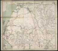

G. Bradshaw's Map of Canals, Navigable Rivers, Railways &c. in the Southern Counties of England ...
- Made:
- 1825-1835
- maker:
- George Bradshaw
G. Bradshaw's Map of Canals, Navigable Rivers, Railways &c. in the Southern Counties of England from Actual Surveys shewing the Heights of the Pools on the Lines of Navigation also the Planes on the Railways from a Level of 6ft. 10in. under the Old Dock Sill at Liverpool / George Bradshaw. ca.1830. 3 sheets, coloured lithographs, each 96.5 x 64.5cm., scale 1" : 2m. 'Dedicated by permission to Thomas Telford FRS L & E, President of the Institution of Civil Engineers'. Bears 'Explanation'
Details
- Category:
- Railway Maps & Plans
- Object Number:
- 2000-1057
- Materials:
- paper
- Measurements:
-
overall: 965 x 645 mm
- type:
- map
- credit:
- Unknown source


