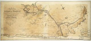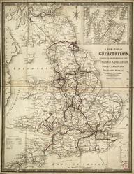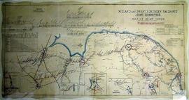
Map, England, Scotland & Wales, Station map, 1854 (3rd Edition), published by Smith & Ebbs, paper backed linen.
Details
- Category:
- Railway Maps & Plans
- Object Number:
- 2002-8039
- Materials:
- linen (textile) and paper (fibre product)
- Measurements:
-
: 52 1/2 x 35 3/4 in.; 1333.5 x 908.05 mm
- type:
- map
- credit:
- British Rail, Clapham